October 23 Another day in Lemon Cove

This morning we found out that the park’s maintenance guy doesn’t merely drag the park’s clanking, screeching and scraping Gannon around (see yesterday’s post) on days when it might be necessary. He does it every day, including today. As far as I can tell, the park looks identical before and after. However, we did find out that the folks we suspected of making the loud bass thumping noises a couple nights ago and who had departed were not the culprits. The culprit was Mr. Gannon Dragger who dismounted and came over to apologize for making the obnoxious racket right before he blamed it on his “old lady” who was allegedly cleaning. He suggested he didn’t hear it until after dark. I did not ask for more information.

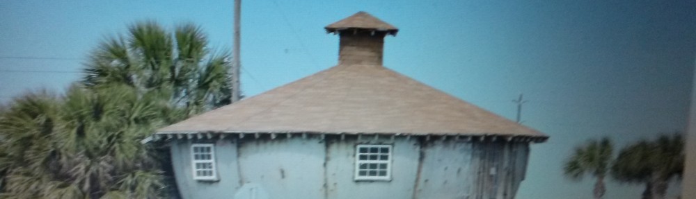
Today our sole venture from the trailer was a short spin into Lemon Cove to top up the diesel tank and ogle some very nice old wooden houses near the only store in town. That gave us ample time to sit in the shade outside and enjoy the surrounding scenery and to misidentify the numerous songbirds that live in the park’s trees. There are a lot of Western Bluebirds, we think.

October 22 Around Lemon Cove

Since we are on what we consider as the fast track through California, we like to lay low for a day or two between travel days to recuperate. Yesterday we were on the road for more than 5 hours, a long time for us elderly types to be doing combat with young drivers recklessly operating faster vehicles, wild-eyed careeners, thoughtless lane changers, urgent quests to find restrooms and cops.

And after last night’s bass and thump serenade lasting well past dark, we spotted what we thought were the noisy types leaving this morning and taking their obnoxious music with them. Unfortunately, a park employee arrived this morning with a tractor equipped with a Gannon drag-behind tool well known on construction sites as an ample noisemaker. The employee dragged this appliance around for quite a while, making sure nobody wanted to remain in what was previously a very quiet park.

So today we tried to avoid the obnoxious racket and did a bit of driving, over to the town of Woodlake where we filled up Charlotte’s ample fuel tank with $91 worth of diesel. We believe that is the most we have ever been required to pay since 2014, when we started this adventure. California’s fuel prices are truly frightening. Less than 14 days ago we were getting diesel for less than $3 in rural Oregon while here in the Golden State we have found only very few places with fuel costs less than $4/gallon and that’s for biodiesel, which is not recommended by Ford in their diesel engines. In Woodlake we turned up CA-245 (the northern ¾ being possibly the most serpentine road in America) for a ways before returning to Woodlake where we rewarded ourselves with some drive-in ice cream.

That’s about it. We went back to our trailer and turned on the air conditioning and poured out some cocktails. The irritant with the Gannon had quit by the time we returned but it was difficult to discern if he did any good. The place looks exactly the same as when we arrived yesterday although it is much quieter.

We took some pix of the Lemon Cove area highlights. Click the link. https://photos.app.goo.gl/bSVWzfqiPSxe3mhq6

October 21 Isleton to Lemon Cove

We continued our southern progress today, leaving the Lighthouse RV Park in the Sacramento River Delta town of Isleton and getting back out on the substandard paving demonstration section known as CA-12. About a dozen lumpy miles later, we turned south on I-5, the main north-south interstate through California. We continued on 5 until we were south of Stockton where we swung east on CA-120 to I-99 at Manteca where we again headed south.

I-99 runs parallel to I-5 from north of Sacramento down to the Bakersfield area but we prefer I-99 since it is less boring, passing through many farming communities. I-5 mostly just passes through dead-flat farmland with nothing but more flat in the distance and an occasional glimpse of aqueducts of the California Water Project moving water from the Delta to thirsty Southern California.

According to our very shaky projection of about three hours of transit on I-99, we were flummoxed by some poor travelers whose $600,000 fancy and gigantic diesel pusher RV inconsiderately erupted in flames and backed up traffic for about five or ten miles, adding about a half hour to our trip. Near the town of Selma, a trucker who neglected to look in his mirror abruptly careened his tractor and 53′ trailer into our lane while we were occupying the space he wanted, forcing us into the #1 lane, a lane we rarely use because California limits us to 55 mph and condemns us to the ridicule and upraised middle digits of the motorists passing quickly on our left.

We finally made it to Visalia where we turned east on CA-198 and headed toward the Sierra foothills community of Lemon Cove. There we pulled into the Lemon Cove Village RV Park where we stayed as we passed through this area this last spring. When we were here back in late April or early May, our stay was pleasant with no nightime noise, balmy weather and Sequoia and King’s Canyon National Parks just a short drive up the hill into the Sierras.

Last time we were here, we were assigned a space where there were no substantial trees to the south, a primary requirement to get satellite TV reception. This time, despite the park being almost completely vacant, we were assigned one of the only spaces with tree to the south so we have a long piece of cable to reach our antenna which is set up in an adjacent RV space. We also found some minor issues with the site electrical pedestal but we quickly got around that. This evening, one of the very few neighbors decided that everybody in the park wanted to hear their loud music which, based on the way it sounded, was mostly solos for bass guitar, bass drum and tom-tom. The only recourse when encountering inconsiderate twits with loud music complaints is to get ahold of park staff to have them enforce the anti-jerk rules. Unfortunately, two attempts to contact management were absolutely ignored and, despite closing all our windows and doors, turning on the air conditioning and turning up the volume on our TV so even the deaf could hear it, we were still serenaded by the type of music that makes people hate those making it.

It is unfortunate that the folks running the park let assholes run roughshod over their other customers because it is a very nice park with good access roads, lots of birds (although we currently can’t hear them), adequate spaces, full hookups and some WiFi. In addition, it is located in a good spot to stop on our long treks through Central California. Maybe we should look elsewhere next time.

See the fricasseed RV. Click the link. https://photos.app.goo.gl/Md5k6RrhtJUGG5Ku9
October 20 At the Lighthouse

On our journeys, we try to pass through California’s Central Valley as quickly as possible since the place is, frankly, quite boring unless interested in farming. From our house in San Diego, we are obliged to traverse this area on any trips to or from the Pacific Northwest so we just have to make do – quickly.

Yesterday we knocked out better than 200 miles, about our limit for a day considering the time to break down and store all our stuff, disconnect from park utilities, hook up the trailer and connect the brakes, get out on the road to do the wayfinding and highway driving at California’s lethal, breakneck maximum towing speed of 55 mph and registering and setting up utilities in the new location.

With that in mind, we went no place today other than a fuel station to fill up the tank because tomorrow we will knock out another 200+ mile day into southern California, specifically to the foothills below Sequoia National Park.

It was quite nice doing nothing today. I seem to be quite good at it.

October 19 Redding to Isleton

The southward progress of our trek towards warmth continued today. We broke camp in Redding and hopped on I-5 for the long leg toward Excremento, capital of California and quagmire of governmental tomfoolery. Fortunately, we exited I-5 north of the rampant shennanigans and turned due south on CA-113, an amazingly lumpy two-lane road that allowed us to avoid the nightmare of official traffic congestion and to soon intersect with I-80. We turned west on 80 for two exits and then continued south on an even lumpier section of CA-113 where the paving is such that all the contents of our trailer were rearranged into a more random arrangement.

After encountering some of the most jarring pavement surfaces available outside a motor vehicle test facility, we came to a surprise roundabout in the middle of nowhere where we turned east on CA-12, toward Lodi and the Sacramento River Delta. After some more mildly terrifying high speed/low passing clearance driving, we got to a place called Isleton where we turned off onto a very skinny road atop a Sacramento River levee which we followed for a few miles before arriving at The Lighthouse RV Park (at least our second “Lighthouse RV Park” on this year’s excursion, neither within sight of any lighthouses) and dropping down their nearly vertical driveway and into our lodgings for the next two days.

This park has full hookups, at least in our space, WiFi available at usurious rates and is located about 30 feet below the the top of a massive dike along the Sacramento River and one downpour away from uncontrollable flooding if the levee breaks. Reassuringly, the dike is made of dirt.

October 18 Mt. Gate RV Park

Today we hung out close to the trailer. We dumped the waste tanks, Peggy cleaned the awning and we ate very well since yesterday’s shopping nightmare is now paying off with the refrigerator and cupboards of the affluent. Tomorrow we will reluctantly leave this place and continue south.

The Redding area is very pretty, the weather has been superb and the surrounding countryside is gorgeous with amazing colorful vegetation, majestic rock and volcano formations, spectacular waterfalls and rivers, beautiful lakes and abundant wildlife. This October, however, it is bone-dry and even the most insignificant error with open flame coupled with some breeze or a volcanic eruption will result in a fiery holocaust that could consume everything in this stunning region. We hope it rains soon. Time to go. ‘Tis the season to be jolly, for arsonists.

October 17 Challenge Shopping in Redding

Redding is a very attractive city but there are only a few exits from I-5, the primary north-south highway in this part of California. The result is an absolutely bewildering web of thoroughfares that go in almost full circles before terminating in uncrossable highways or dead ends near the freeway. All of these busy roads have substantial dividers running down the center, potentially averting collisions but certainly eliminating free thinkers and fuel economy buffs from taking the shortest or most efficient routes. Left turns are almost right out. This area offer numerous visible businesses where “You can’t get there from here,” or maybe anywhere.

Despite this confusing arrangement, we were able to find the Redding Costco which, it turns out, is almost adjacent to I-5 although we went through multiple stoplights at busy multi-lane intersections before turning east and north and south and west and ultimately entering the parking lot. After an ample re-supply, we then went through more counter-intuitive rambling before arriving at a Trader Joe’s where additional retirement dollars flew out of our accounts in exchange for some of T. Joe’s tasty products which went into our stuffed larders back at the trailer. Returning home was the highlight of today’s ramblings.

October 16 Burney

Unlike yesterday, we saddled up and headed out for a cruise through the areas east of Redding, CA. In accordance with past practice, the destination was quite nebulous at the beginning but resolved itself as we proceeded. We started out by getting on a rural two-lane road called Old Oregon Trail about a half mile from our park near I-5 and were treated to a delightful drive through both mountainous forested areas and massive pastures, most of them occupied by cattle browsing on the stubble. It was extremely dry here and looked like an errant spark could start a conflagration of epic proportions. There were many deer hanging out by the road and flying raptors above.

After a while we came to the intersection with State Highway 299 which is the main, and sometimes only, route from the coast over at Eureka and into the mountains at Alturas, over by the Nevada border and US-395. We we turned east on 299 at an elevation of about 1200 feet and passed through tiny communities called Bella Vista, Round Mountain, Montgomery Creek and Hillcrest before getting to 4000 feet and Burney, the first real town for about 60 miles. It is a gorgeous drive, although serpentine, through mixed conifer and hardwood forests. The hardwoods were putting on a gorgeous, colorful display of multi-colored foliage before going into their ugly, stick-like wintertime dormant phase.

We continued through Burney and a little community called Johnson Park before turning north on CA-89 to the McArthur-Burney Falls State Park where we coughed up the $10 entry fee to enter the park. We easily found a place to park in the almost empty parking lot before taking a very short walk to a spot on the edge of a deep gorge where we could see the fabulous Burney Falls. In the volcanic sedimentary rock in this region, water frequently finds funny ways to run downhill and Burney Falls is a superb example. The main falls cascade from the top of a cliff but about halfway down the abrupt cliff face, a much wider sheet of water has found a way through the sedimentary layers resulting in a curtain of water about 150 feet wide also falling into the 25 foot deep pool of crystal-clear water at the bottom. It is gorgeous. Teddy Roosevelt visited years ago and thought Burney Falls should be the Eighth Wonder of the World. This park was certainly worth the $10 we spent to be dazzled.

We spent quite a bit of time here because the waterfall and adjacent Lake Britton are so stunning. Eventually, however, we had to leave. We were in basically uncharted territory for us so we looked at the map and found a town that shares the name of Dana with our daughter. We headed a bit further north before turning east again on County Road A19, also known as McArthur Road, and after about 15 minutes pulled through Dana. It is a scattered community with houses visible in the flat distance and a defunct Dana Market which looked closed. This area is a massive high pasture between mountain ridges and is very scenic. We continued on A19 for another dozen miles before turning onto A20 which took us due south and back to CA-299 and another community called Fall River Mills. Unfortunately, we were running out of daylight by that point, especially since the sun had dropped below massive ridges to the west of us, so we turned back toward home on CA-299.

CA-299 is a treacherous, high speed, serpentine road with strenuous climbs and descents and it is also absolutely spectacular for roadside scenery.

We took a few pictures along the way and they can be seen by clicking the link. The fifth wheel trailer in one of the pictures is not ours. https://photos.app.goo.gl/chLvmHVN1PLV2RQx8

October 15 Malingering

There were firm intentions to blaze out of our current digs at Mountain Gate RV Park and whirl around doing unproductive but fun stuff. We didn’t even get that far. We hung out near home, enjoying the balmy weather and watching the birds. The only productive thing accomplished was to dump the waste tanks.

October 14 Carr Fire

In the last few years, California has been plagued with horrible, runaway brush and forest fires. One of the more recent conflagrations was the Carr Fire, which burned a substantial amount of forest and grasslands here in Shasta and adjacent Trinity Counties. It was started by a sparky wheel from a tire failure resulting in 230,000 acres (358 square miles) of pine and oak forests and some 1600 buildings being fricasseed between July 23 and August 30, 2018. Quite a bit of this land was within the Whiskeytown National Recreation Area although there is substantially less recreation now.

Today we took a spin through the abundant burned and few lucky unburned areas involved in the fire. Most of the forests are now huge expanses of big pointy black sticks devoid of leaves, needles or branches. Fire is funny, vigorously rubbing out some areas and leaving others unscathed. One of those places is the tiny town of French Gulch where all two blocks of downtown is intact but the majority of outlying houses are now just grubby flat spots with scorched driveways and this spring’s weeds popping out everywhere. All the communication and power poles and lines are new.

We took a spin up to Shasta Dam and Lake, the largest man-made reservoir in CA. There are nice views of the dam, lake and Mt. Shasta in the distance.

Today was also my beloved Peggy’s birthday so she got to choose where I was going to take her for dinner. As usual, her choice was superb, selecting a great Chinese restaurant called Sailing Boat in Redding that served very tasty food. Our waitperson was from India but had strangely gone to Marston Junior High in San Diego in her youth. Marston is located about 8 blocks from our house in San Diego and the same school where both our kids went to junior high. As I remember, both kids hated it.

We took a few shots of areas unburned, which were quite nice. Click the link if you wish to see them. https://photos.app.goo.gl/1rJ4Mg9fb8tWz2N89