Not long after arriving back at our Barbarian Invader following our trip into Vicksburg yesterday, it started to rain. We turned on some local news and the Weather Channel to check out what was in store and almost wished we hadn’t. The weather maps depicted large, fast-moving radar representations of the oncoming weather and they were a variety of brilliant colors. We now know that dark green is merely hard rain, yellow is the violent thunderstorms and the various shades of red and almost purple are tornadoes. No sooner had we figured out what county we were currently camped in than a tornado warning came up that urged us to take shelter in a sturdy building. The only building that was any sturdier than our trailer was the RV park’s restroom and shower facility. Instead of spending a long time in the crapper, we hung on until we got more information about any actual tornadoes.
The rain ahead of the thunderstorms and while the storms passed over was delivered in a torrent, coughing up an inch and a half in about 40 minutes. There was a period of about an hour where the lightning was firing so often that it rarely went back to pitch black between strikes. The thunder was awe-inspiring; it sounded like the sky was being ripped in half. By the time I just about ready to clean out my trousers, we were able to get reception again and our tornado warning had been changed to 60 mph straight-line wind, hail and flash flood warnings. The weather stations this morning only confirmed a few tornadoes and none where we were but they also indicated flooding in Vicksburg. The temperature this morning (45 degrees) was 33 degrees below the temperature last night during our attempted drowning. I have never witnessed lightning of the proportions we saw last night. It was like being in a disco with a strobe operated by an amphetamine-crazed spastic.
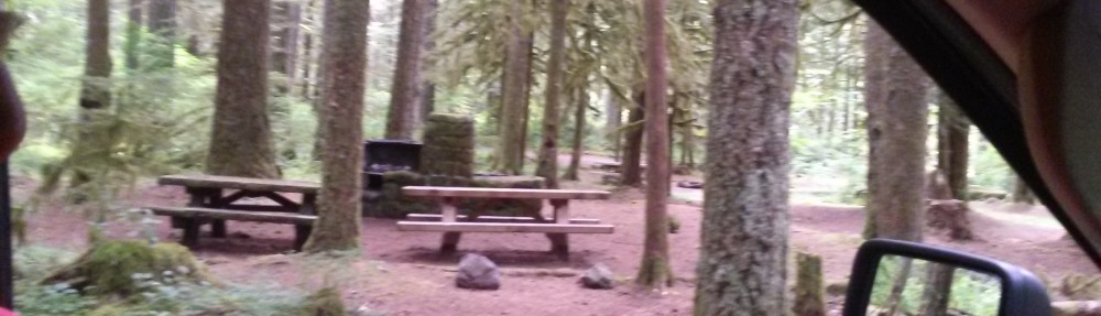
There was a fine drizzle when I went out to make preparations for departure this morning. Not long afterward (I was in my usual attire of shorts and a T-shirt) the chilly weather had accelerated my efforts and we were out of the Rivertown RV Park and headed up US-61 toward I-20 before 10:30. We continued east through intermittent rain on I-20 to Jackson, the state capital, where we got off at the LaFleur’s Bluff State Park. After stupidly going to the listed address, we were told that the campground entrance cannot be accessed via the park entrance so we pulled a U and continued a bit further to the proper entrance. The campground is quite pretty, located on the periphery of a lake with lots of birds but no sewer hookups. We’ll be using the on-board waste system for a few days. It was a chilly 43 degrees with a light drizzle when we arrived; set up was pretty quick so I didn’t have to change my clothes.
Check out the picture of our neighbor. Click here
Monthly Archives: April 2018
April 6 Vicksburg
The Vicksburg National Military Park was our destination for today. We were trying to squeeze it in between breakfast and the onset of a massive and nasty storm approaching from the west. We have never been in this part of the world before so we had no idea what to expect; our first stop was the park’s visitor info center. The VIC parking lot was filled with big tour busses on the paved section and lots of cannons on the grassy parts.
The park consists of two loop roads – the outer loop where the Union forces were surrounding the Confederate forces who held the inner loop. Inside the Confederate loop was Vicksburg, a crossroads for river and train traffic supplying the Confederate Army throughout the South. On both loops, many memorials have been installed where each unit from each state was positioned during the initial battles and finally a 49-day siege. There are memorials to each military unit (Iowa 22nd Cavalry, Missouri 49th Light Artillery, many others), each state that sent soldiers to fight, almost every officer above the rank of colonel and, surprisingly, some distant non-participants. Blue signs depict where Union forces were positioned and red signs show the Confederate lines. Sometimes the lines are very close – maybe 15 feet between them. They must have been able to spot each other because there were 19,000 battle casualties with about 3,600 killed. Where the lines are further apart, there are large expanses of deep grass. I imagine anything bigger than a twig between the lines was vaporized in May 1863.
Also inside the park is the reconstruction of the U.S.S. Cairo which was originally an ironclad patrolling near Vicksburg where the Mississippi and Yazoo Rivers come together. The Cairo must have sailed a bit too close to the Confederate shore batteries because it was sunk in the Yazoo. The hulk was excavated from the mud and reassembled under a nifty Kevlar tent many years later. The park also holds Vicksburg National Cemetery where the abundant dead bodies were interred after the siege was over. The Confederates lost the siege and the South was pretty much screwed thereafter due to supply issues.
The park is fantastic. There’s plenty of places to wander around afoot but the whole place can be seen by taking the 17 miles of loop roads in a car. Those who gotta go should probably do so before entering the park because once you go in, you won’t be getting out for a while and you will exit in a different place than you entered. Two entries (but only one entry fee) into the park are required to see both sides’ positions. It must have been a horrible place during the spring of 1863 but is quite breathtaking now. Abundant birds sing in the trees.
After two loops through the park, we headed into Vicksburg to check out the great architecture and the waterfront bordering the Mississippi. They had a glorious train station you can check out, modern paddlewheeler landings and barge traffic up the Yazoo.
There are some pictures of Vicksburg if you click here
April 5 A bit further up the Trace
We used our day today traveling on our next segment of the Natchez Trace. Those tenacious enough to have read the last few days of this blog have probably found that there is considerable mention of the Natchez Trace. Our intention is to cover the entire distance of this historic American trail during this year’s tour. I should have mentioned this previously but I’m an old guy and I’m sticking with that as my excuse.
We are currently camped off the Trace near Vicksburg so we drove north on US-61 until we started going east on I-20 for about 20 miles, intersecting the Trace at Raymond, a place that is labelled with a sign because there is nothing else there. Before getting to Raymond, we did spot some roadside Americana and some nifty old houses and we also found a residence where the owner has a maybe 3 foot high circle of beer cans about 15 feet across neatly piled in his front yard. There doesn’t seem to be any recycling in Mississippi because if there was, the guy would be rich. We then turned south on the old road to fill in our next increment of Trace exploration. Along the way the two-lane highway gently curves and climbs and descends over small hills as it passes through gorgeous hardwood forest. We did find it strange that this road, without the benefits of rural electrification conductors and poles, people, billboards or even any intersections was not a place to find wildlife. We saw a lizard, two snakes and some birds. We saw two deer but they were both road kill and at the center of big vulture get-togethers.
We stopped in at a former town called Rocky Springs that was a settlement of some 2,500 folks back in 1830 but poor soil conservation, the Civil War, the boll weevil and the abolition of slavery have left nothing but a Methodist church, a safe bolted to the ground and a cistern. It is located in beautiful surroundings but there’s just nothing left. Most of the former structures’ foundations are gone because lousy soil practices have turned the place into a very green badland.
We exited the Trace in Port Gibson, where we checked out some of the beautiful old houses and churches before getting on US-61 for the return trip north to Vicksburg. One of the churches has an enormous gold fist pointing its finger into the sky for some reason. It was a very spiffy finial for their steeple. I wonder what it means.
Check today’s pix by clicking here
April 4 Vidalia to Vicksburg
Last night, our Weather Underground app indicated we were in the line of some thunderstorm activity starting right after dark and they were right. We had beautiful blue skies, balmy temperatures and light breezes right up until the front passed through and everything changed right after that. The wind came up to about 50 mph and some serious rain started to fall, giving us about an inch in maybe 15 minutes. We even developed a leak in our trailer where the whistling wind drove the rain right through our living room window. Once the wind dropped down to a velocity that was conducive to standing up outside, the window leak quit and the rest of the trailer was as dry as a bone.
Today we left Vidalia, LA, and headed into Mississippi. We drove north up US-61 toward Vicksburg, MS, and, other than where there were people, it was quite beautiful with abundant roadside wildflowers, great forest scenery and a road making gentle curves through a sylvan landscape. The pastures are emerald green except where it is flooded and there is a bunch of underwater real estate. Where there are people, it is pretty plain that the folks in this portion of Mississippi are not affluent. In Port Gibson there are some spectacular buildings that Union forces made the decision not to burn because it was just too pretty but the rest of the settlements and little neighborhoods along the road appear to be the result of grinding poverty and are ugly.
About 60 miles after crossing the Mississippi River, we pulled into the Rivertown RV Park 5 miles south of the city of Vicksburg where there were numerous skirmishes and some truly horrible battles during the Civil War. Vicksburg itself was the subject of a 49 day siege that ultimately ended up with the locals surrendering before they were pounded to dust.
The Rivertown is a well-kept park with gravel roads, full hookups and wifi of an unknown quality overlooking a small regional airport or alleged airport because, so far, we have seen one helicopter and no planes. The horrible thunderstorms of last night have given way to gorgeous skies but cool temperatures in the 60’s. We will go exploring tomorrow.
There are two pictures showing the two types of terrain we encountered on today’s drive. Click here
April 3 Vidalia
This is our last day in Vidalia and Louisiana on this trip so we did the usual tank dumping and grocery shopping. Fortunately, this left quite a bit of time to watch the Mississippi flow by. We started our trip into the town with a ride down a gravel road that runs on the levee along the river. In the west, a levee is called a dike. We had not gone far when the levee road dropped us off in a beautiful Vidalia park that runs along the west bank for about 1/2 a mile. They have installed nice benches, swings and chairs overlooking the river for folks like me that just want to go down to the banks of the river and take it easy. It is very pretty and the scenery constantly changes.
A bit further down the road we came upon the Vidalia Graveyard which is built along the edge of the river and a neighborhood that looks like it floods regularly. They bury folks differently here than back home in California. One of the differences we noted is that the deceased are interred in big concrete vaults only partially buried into the ground. Perhaps it is to keep their moldy bodies from popping out of the ground when the graveyard floods. They also have what we would consider to be strange or bizarre headstones with football team names and odd sculptures that will live on in eternity or until there is some urban renewal.
We felt we needed a reward for exploring so we stopped in again at the Butt Hut to dine. We both selected what may be the best hamburger I have even consumed called a Butt Hut Burger which has about a six-inch diameter, a pretty impressive burger patty, a layer of sliced barbecued brisket, bacon, cheese, BBQ sauce and cole slaw. To make sure this was lethal to my heart, we also got some of their superb onion rings which they call onion straws for some reason. I was quite satisfied at the conclusion of dining.
During our stay here across the river from Natchez, we went into that venerable city twice to dine. One time was at a Wendy’s that we should have known better because all their food did was give our fancy RV terlet a workout. We also ate at a much-touted place called Fat Mama’s Tamales. Their tamales are the tiniest tamales I have ever seen. They are less than an inch in diameter and about 3.5 inches long. They tasted okay but seemed to be insufficiently spiced, greasy and basically boring. Peggy had a taco salad and she characterized it as “terrible.” I also had one of their “Knock you naked” margaritas and it wouldn’t hold a candle to anything available in Mexico except those drinks sold at Los Cabos International. It neither made me naked, prone or even slightly buzzed. Should we ever return to Natchez and Vidalia, I’ll keep my dining activities on the Vidalia side of the river, namely, at the Butt Hut.
We took a few pictures. To see them, click here
April 2 Another bit of the Trace
Exploring was again on the agenda for today. However, we decided to take a more intelligent approach by stopping by the Natchez Tourist Info Center where we got maps and some verbal instructions about where we wanted to go. After leaving, we decided to go south of Natchez to the St. Catherine Creek National Wildlife Refuge.
Unfortunately, all the roads we tried were flooded way before we got to the ends so we were limited to seeing one alligator and a crow. Defeated on this venture, we decided to head a bit further up the flower-lined Natchez Trace, this time going as far as the town of Port Gibson where we encountered some more gorgeous buildings. We did not expect to see such spectacular architecture in such a rural setting.
We chickened out after Port Gibson and returned to Vidalia to watch more river traffic. This time we arrived in time to see a single massive river tug pushing 28 loaded barges maybe a couple hundred feet long each upriver. The barges were arranged 4 wide and 7 long. It is amazing that the tug pilots can manipulate their quarter mile long loads through the numerous bridges here without hitting the supports. I hope they don’t screw up because it looks like some of the barges have a cargo of gasoline or diesel. Lots of barges going upriver today.
Pix. Click here
April 1 Natchez and a bit of the Trace
We were in exploration mode this morning although it was difficult to leave our front row perch overlooking the Mississippi River and the fascinating barge traffic moving up- and downriver. We can hear the low rumble of the towboat engines a long time before we can see the barges but, after a long procession of goods, the massive river boat pushing the load will pass by our RV. The biggest array of barges being pushed by one boat we saw today numbered 18 lashed 3 wide and 6 long in front of the giant river tug. We noted the tugs make more noise and create a much larger wake going upstream. The river looks like it is going at about 5 to 10 knots headed for the Gulf of Mexico about 200 miles downstream. It is great being right on the edge of this mighty river.
We finally drug ourselves away from the river’s edge and headed across the Mississippi into Natchez to check out some of the residential architecture. Despite having a population of around 15,000, the number of spectacular buildings is way out of line with the number of folks living here. The primary reason is because most of the spectacular houses were plantation estates owned by folks who made their money from cotton picked and processed by slaves. It is probably quite easy to make a fantastic estate for yourself if you never pay for the labor that did the actual work. Slave owners were shitheads but, not surprisingly, there is no mention of that around these parts. This part of the world just thinks slavery was a quaint custom and all of its former evils can be ignored. There are still a lot of the folks that refuse to acknowledge the dreadful evils of owning people who have no hope of redemption. The buildings we saw in Natchez were truly magnificent structures with lawns big enough for a Super Bowl although the rich families who still own them charge $20 a head to go in and look so we did our recon from the street.
After a bit of clumsy driving around on Natchez streets with their one-way sections, forbidden turns and dead ends, we chose to get out into the country for a bit so we headed up the first section of the Natchez Trace. The Trace was the shortcut for those late 18th and early 19th centuries who used to raft goods down the Ohio and Mississippi from northern climes, sell the goods in New Orleans, break up their boats for lumber and sell it and then return home via a long walk on the Trace. If one follows the shoreline home, it is about 2000 miles up the Mississippi and Ohio Rivers. It is only 450 miles up the Trace through the Tennessee and Ohio Valleys to Nashville. We stopped in at an old inn called the Mount Locust Inn from about 1800 that was the first stop up the Trace for those who did not want to get robbed by trailside bandits. It looks old, but comfy.
The Trace road has a maximum speed limit of 50 mph but we seemed incapable of maintaining that rate because the scenery is gorgeous. There was almost no traffic so we didn’t piss anybody off by stopping every 1/4 mile to gawk. After about 15 miles, we turned off the Trace and returned to Vidalia, rewarding ourselves by stopping at a local eatery we found called the Butt Hut. They have excellent barbecued stuff. The brisket is almost divine. They offer a Butt Hut Burger with a beef patty, a covering of the crispy tasty parts sliced from the outside of the brisket, grilled onions, cole slaw and BBQ sauce of your choice for $9.
There are photos of some nice Natchez cribs you can see by clicking here
March 31 Alexandria to Vidalia
Today was a travel day. We have enjoyed the area around Alexandria and Natchitoches since the food was great, the people were friendly and the scenery is magnificent even though the place is basically flat and does not drain well. There is a remarkably high number of single-wide trailers with fuzz on the outside and an abundance of broken stuff in the yard. I didn’t even think they made single-wides anymore but this place proved me wrong. Maybe it is just that all single-wides come here to die and they are doing a bang-up job. We hunkered down in our trailer through nearly 7 inches of rain the other night, a condition the locals refer to as a frog strangler. We also learned another local word, bullfuzzle, which apparently means bullshit. The place is terrific.
As we disconnected from the utilities today, I found a cute little frog in our electrical pedestal where he had climbed in order to avoid being drowned the other night. He was firmly clinging to the male end of our electrical umbilical and he did not want to leave.
We traveled around 100 miles east through some flooded terrain (swamp) but emerged into flat farmland near Vidalia. Vidalia is located directly on the Louisiana side of the Mississippi across from Natchez, Mississippi. We pulled into the River View RV Park and were surprised to find that we had a terrific spot in the front row, looking out on the Mississippi River and the considerable barge and riverboat traffic doing their commerce stuff. Many rafts of barges consist of eight or more individual barges tied together and pushed up- or downriver by massive tugs. The boats pushing the clusters of barges make a low rumbling sound as they pass. The riverboats have paddlewheels, similar to a lot of technology we have seen in this region.
See pix. Click here
March 30 Natchitoches
Today we took a spin from our current RV park in Alexandria north to Natchitoches. There is some question in my mind about how this town’s name is pronounced. Over in Texas, they have a town named Nacogdoches which they pronounce NACK-ih-do-chez. Acoording to the locals over here in Louisiana, the word Natchitoches is pronounced NACK-ih-tesh. There is also a town called Nacogdoches in Louisiana and I have no idea how they pronounce that.
Our route, LA-1, took us through miles of fabulous roadside wildflowers, beautiful rural estates with massive emerald pastures, Dogpatch-like settlements and flooded areas extending to the horizons. Not far from Natchitoches, we pulled into an old plantation estate called Melrose that was owned by freed slaves. They have the original estate residence and a bunch of outbuildings preserved on the site along with a great garden surrounding the buildings. We lingered here a bit longer than we should have but it was very pleasant sitting in the garden and we decided to ignore being bad.
We finally continued up the road into Natchitoches and were pleasantly surprised by the fabulous architecture of the downtown buildings and surrounding residences. There are beautiful massive oak trees on both sides of the residential streets and they form a gorgeous, shady canopy over the road. Natchitoches is quite beautiful, despite the pronunciation of the name. We stopped in at a place called Lasyone’s for their famous meat pies. They are very tasty. They are much better than the meat pies we purchased in 2015 in St. Ignace in Michigan. In Michigan they call them pasties but change the pronunciation to PASS-tees. I guess the eating of nipple tassels was just too much for the folks on the Upper Peninsula.
We returned to Alexandria back down LA-1 despite our policy of avoiding backtracking over routes we have already traveled. It was just as gorgeous going the other way. We did spot some agricultural equipment here that I have never seen before. It is different in that the drive systems are set up to make it so the equipment can get through the seas of mud that are the fields. It looks funny, but useful.
We got a few pix and you can see them by clicking here