April 30

We are extremely fortunate. We do not have to get up early so we didn’t, arising about 9:00 and starting to move away from the coffee pot by 10:00. By about noon, we jumped into Charlotte and took off for the town of Roaring Gap, which, according to the crummy maps we have, is only about 5 miles away. Some 15 miles later, we drove into Roaring Gap, which is a tiny little burg with a small market, a gift store for other people and two golf courses right in the pass through this part of the Blue Ridge.
In Roaring Gap, we spotted a sign showing another way into Stone Mountain SP and took it down a very scenic but quite narrow road with lots of curves and few straight sections. No traffic made it so we could descend from Roaring Gap at about 10 mph which was great because it is a gorgeous drive. However, I’m glad I did not bring the Invader in this way because it probably would have made some poo come out.
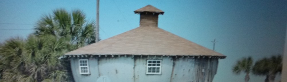
We re-entered the park and drove to the visitor center to scope out the exhibits. We met the neat lady who works there, Denise, who told us about the area & allowed us to access the center’s back deck where we finally were able to see a pretty big chunk of Stone Mountain albeit from the side and from a distance. She did reveal, however, that there was a great spot to see the mountain, right up close, and to visit a pioneer homestead and we could drive right into a parking lot at the spot. She was absolutely correct. If you ever come here, make sure you go see the Hutchison Homestead because the view of the mountain from here is truly impressive and the homestead is pretty neat, too.
From this vantage point, the entire width and the 600 foot height of this enormous dome-shaped monolith is plainly visible humbling us mere pipsqueaks. Great spot for photos and we took a few while hiking around the homestead area.
We departed the Homestead and took one more drive through the park road. There are flowers and buds popping out that were not here two days ago and it was sort of like driving on a road we had not traversed previously. This place is gorgeous and at this time of year remarkably uninhabited. If I lived around here I would probably visit all the time.

April 29

Another section of the Blue Ridge Parkway today. We drove north up I-77 to Virginia and got off at Exit 8, Fancy Gap, VA. We turned south back toward NC passing the closed and gated Blue Ridge Music Center, Cumberland Nob, Fox Hunters Paradise to Hwy 21 where the Parkway was closed and we were detoured north on Hwy 21 then west on Hwy 18 which we followed all the way back to County Road 1002 and Stone Mountain. Just like every day we have enjoyed on the Parkway, this one was another treat and we spotted 5 wild turkeys, to boot.
We still have not really seen Stone Mountain from here in the park but we did see it from about 50 miles away when we were on the Parkway three or four days ago. Sure would like to see it before I leave.

April 28

Today we departed Green Mountain Park Resort in Lenore/Lenoir and wandered off towards Elkin, NC using single-lane (in each direction) highways going mostly northeast. We started on Hwy 18 to Hwy 421 to Hwy 21 to County Road 1002 into Stone Mountain State Park which is bordering the Blue Ridge Parkway on one side and Hwy 21 to the north. The entire distance from Lenoir to this place near Roaring Gap is a wonderful drive through small rural farming operations, areas of hardwood forest, wandering up creek-side ledges and having straight, flat runs through emerald green pastures. This might be the first time since we started on this mission from God (The mission assigned to us was to wander about aimlessly without concerns regarding schedule) that the drive equaled the scenery at the destination.
After maybe the least informal check-in operation yet, we pulled into an enormous, paved, mostly level site in a small pasture. The 50 amp system was funny but the 30 amp electrical system worked fine. The water is good. We’ll find out about the dump station when we check out.
Despite driving way below the speed limit all the way here, the distance traveled was short and Peg & I had the Invader set up in record time. First we drove over to the closest picnic area and found a trail that was initially intended to take us to Stone Mountain which we have not seen yet. After walking .3 mile, we hit a trail intersection indicating there was a 4.5 mile trail to Stone Mountain and a .3 mile trail to Stone Waterfall. We opted for the waterfall and I’m glad we did.
The trail leads you to the top of the waterfall with a big viewing area and the trail continues down quite a few steps to an intermediate platform and finally to the bottom of the fall. It isn’t what you would normally consider a waterfall because the water never passes through air but instead runs down an increasingly steeper rock dome. It is still spectacular. It is an easy hike of about a mile and a bit, round trip.
From the picnic area, we drove the 600 yards back to the Invader where we gathered up some snacks and piled back into Charlotte for a spin on the only road going through the park. It is a great drive down a series of creeks with abundant sprouting and flowering vegetation everywhere. There was almost no traffic, so we were able to putt along at about 10 mph on the paved section and maybe even slower than that on the last short gravel section. We were still unable to actually see Stone Mountain except little glimpses from the road, through trees. We really didn’t care much since the drive through the park is wonderous.

April 27

Woke up this morning to the first sunny day in about 2 weeks. When Peg & I turned on the Weather Channel to check out the forecast, they had just turned the segment over to a local commentator who indicated there was very rough weather in “Byu-mont,” TX which I can only surmise was her pronunciation of Beaumont. We truly do have a variety of languages and dialects in this country although, until recently, I had assumed we mostly spoke English.
We drove into Lenore or Lenoir and cozied up in a Waffle House. Peg had some Waffle House free food cards that had been given to us by Gary down in Greenville, SC. A short trip to a B of A to get some cash, a side-trip to get diesel and then we were on our way. It seemed like a perfect day to take another trip up to the Blue Ridge Parkway since the pundits on the Weather Channel said we could expect clear conditions. They were correct, in this case.
We started driving up Hwy 321 which passes about 2 miles from our camping spot and continued until we reached the Parkway at Blowing Rock. We could see quite a few things which were completely shrouded by fog yesterday but, mysteriously, we were still unable to find the Tweetsie Railroad probably through a total lack of effort. We started our tour today by going east. We found that this section of the Parkway is at not quite as high an elevation as the section we drove yesterday. However, the overlooks along the road are still quite gorgeous and the superb weather gave us views of a horizon that must have been about 90 miles away.
Only cattle, a few crows and one ground hog in the animal count today. We continued on the Parkway to a town called Laurel Springs where we turned down Hwy 18 to North Wilkesboro, on to Wilkesboro and then west back to Lenoir or Lenore.

April 26

4/26/15 Another day of semi-planned wandering. We departed the Invader and initially drove into Lenoir, which the folks in NC pronounce “Lenore,” probably because they have no idea that almost the entire remainder of the world pronounce it “Len-whar.” There seems to be many funny pronunciations in the Carolinas. In SC, they pronounce Beaufort as “Bufort.” I have no idea how they pronounce the name Beauregard.
Anyway, we drove into Lenoir and took Hwy 64 west to Morganton, NC, birthplace and former residence of Sam Ervin, who was the special prosecutor during the Watergate fluff-up during Ex-President and slimeball Richard Nixon’s administration. We turned north from there up Hwy 181 to another section of the Blue Ridge Parkway. On the way up 181, Peg spotted what was either the biggest pheasant in North America or a large female wild turkey. She was a cutie. We also encountered serious fog with very low visibility at about 2500 feet elevation which continued up to about 3100′. We turned east on the Parkway and, again, were not disappointed. There are neat little waterfalls right next to the road, beautiful picnic areas, plenty of pull-outs and the engineering of the road itself is extraordinary. There are numerous bridges spanning multiple creeks that pass under the road and there are also some causeway sections where the entire roadway is installed on top such that you drive on a ribbon suspended above the landscape.
We continued on the Parkway until we came to a town called Blowing Rock. This town is another tourist trap-type unit, probably because there is an amusement park here called the Tweetsie Railroad which we carefully avoided by refusing to find it. We turned down Hwy 321 to get back to “Lenore” again and the top section of 321 was heavily shrouded with fog such that visibility was about 50 feet at the bad spots. There was also a bunch of road construction fun which was cleverly concealed by the fog but the Dept. of Transportation must have gotten bored because the construction stopped right about time the visibility improved.
The Blue Ridge Parkway is a truly magnificent route through this part of the world and if I get another chance to drive this road, I will. The maximum speed limit on the Parkway is 45 mph which, considering the scenery, is too high. I am sure I pissed off those that happened to come up behind Charlotte because we rarely broke 25 mph through this section of the road.

April 25

Boxed up our stuff, hitched Charlotte to the Barbarian Invader and departed Pride RV Park for the Green Mountain Park Resort (a TT campground that we use free or almost free) in Lenoir, NC. This park, for some reason, has a surcharge for Thousand Trails Elite members like us which is strange because no other TT sites we have used this year have an additional charge. I’m not too sure why this park has an additional charge because it is not any better really than any other TT park. The roads are just fair, the spots are pretty close to each other and there are no amenities that we don’t find in other TT properties available here. It is crowded, however, so somebody must like the place. It is also quite scenic, which may explain their reasoning when attempting to justify the egregious practice.
Quite a few of the spaces seem to be inhabited by folks that appear to be living here permanently, which seems to drag any of the parks we have seen downwards. I am a bit surprised TT allows this kind of arrangement – I suppose some new CEO has decided that the organization can make some money by selling some of the camping spots to permanent residents although it does diminish the number of spaces available to paying members. Maybe some day I will write a nasty letter to them to whimper about this practice although I am certain they have no need for nor want my input on this issue. I just wish that the sites they sold to permanent residents were not the really nice and/or big spots which affects bozos like me with big 5th wheel RVs.

April 24

Another drive into the Great Smoky Mountains NP. We drove up to Newfound Gap again and then returned back down the NC side to a town called Cherokee, which, surprisingly, is filled with Cherokees. There were Cherokee gift shops, Cherokee restaurants, Cherokee antique stores and most everything else Cherokee. We had no hankering to stop for anything here so we whizzed straight through town. We continued on down the rural road (Hwy 19 although highway is a bit much to call this road) through Birdtown and Ela until we reached Bryson City where we returned to Hwy 74 and turned east back to Waynesville.
We ate at a Bojangle’s chicken & bisquit place in Waynesville (the food was actually quite good – no french fries required to be purchased with your meal) before pulling into an Ingle’s supermarket in Waynesville to re-stock the larders in the Invader. We returned home just in time for me to catch the last 125 laps of a NASCAR X?#!!?? (next lower class to Sprint Cup) race from Richmond, VA, which I thought was terrific.

April 23

Aaaiiii! It was wash day again so we used the Pride RV Park laundry facilities, did some trailer and truck maintenance and sat in the glide down by the creek in the park and watched the ducks and geese float by us. Very little else consumed our time on this date.

April 22

Another sightseeing day. Today our meanderings took us from the Pride RV Park to Maggie Valley, where we turned towards Great Smoky Mountains National Park by using a section of the Blue Ridge Parkway. The Blue Ridge Parkway is a squiggly road in this part of NC but if you drive to the Park this way, you will arrive at Hwy 441, which crosses the park south to north, at the Oconaluftee Visitor Center. It is a very nice visitor center and they have good bathrooms which are nice at my advanced age. This place is where the truly spectacular part of the road begins. The first 15 miles or so run pretty steeply uphill to Newfound Gap (elevation 5043′), the pass folks must have used to get from NC to Tennessee.
There are a series of beautiful tunnels on the NC side, in addition to numerous waterfalls right next to the road. All the waterfalls are feeding the Oconaluftee River which borders the road. This is a truly spectacular, bucket-list type of highway. The good stuff continues once you cross into Tennessee, where you will encounter more tunnels and a section of road that actually does a 360 with you driving over the top of a tunnel and circling around to pass through it. The only thing that was a problem on this road was regularly pulling over to let faster cars pass as they missed most of the scenery.
Once we got back down to the lower portion of the Park, we took a road to a place called Cade’s Cove. It is about a 25 mile drive up through some of the most beautiful hardwood forest scenery that may exist in this country. The road crosses back and forth across rivers and creeks and runs adjacent to numerous waterfalls and dripping rock cliffs before arriving in Cade’s Cove. Interestingly, there is no body of water here and, therefore, no coves but they call it a cove anyway. There is an 11 mile driving loop where we spotted lots of birds, three black bears, three elk, old residents’ cabins, a grist mill powered by water that is still functioning, some old barns and a few churches, which all looked identical. The churches all had crummy foundations made from a couple of stacked flat rocks.
The drive back down the road from Cade’s Cove is just as good as going up there since you get a different view of everything. Another bucket list section of road.
Once we got back to the northern end of Hwy 441 on the Tennessee side of the park, we drove north to Gatlinburg, which is a big tourist town. They even have a Ripley’s Believe It or Not, the trademark establishment for many tourist traps. From there we drove east on two-lane blacktops until we hit a section of the Foothills Parkway where we were able to continue on to I-40 for the drive of some 45 miles back to the Maggie Valley turnoff and the Invader.

April 21

Today we drove into Asheville to see the Biltmore Estate, former home of some of the Vanderbilt clan. The drive through NC to get there is very nice but the estate is truly spectacular. It costs a bit more than $60 a head to get in, which seems a little steep, but the place is pretty spectacular.
Just driving up the 3 mile long driveway is very scenic and once you park and hike to the house, you are reminded that the rich in this country are really rich. The house should actually be referred to as a castle since the interior living space only occupies about 4 acres of floor space which these poor folks have divided up into a mere 250 rooms. The breakfast room is substantially larger than my entire house and other rooms, like the entrance hall, the winter garden (indoors), the billiard room, the banquet hall, the organ loft, the salon, the music room, the tapestry gallery and the library pretty much chew up all the first floor space. On the second floor one finds the second floor living hall, Mr. Vanderbilt’s bedroom, the oak sitting room and Mrs. Vanderbilt’s bedroom have used up the meager 40,000 square feet of available space. Hiking up the stairs to the third floor gets you to the guest quarters, the 3rd floor living hall (which is a pretty wide hall), the Louis XV hallway, the Damask room, the Claude room, the Tyrolean chimney room and the Louis XV shitter, which is quite nice. We wandered from the 3rd floor down to the basement because you can’t go any higher in the house unless you pay more. The basement has a big indoor white tile pool which looks like a torture chamber, an indoor bowling alley with a human pinsetter, a Halloween room, dressing rooms and an exercise room which has what is described as a rowing machine but appears to actually be a butt-and-arm powered chainsaw. Also found in the basement are servant’s rooms which are not quite as spiffy as the guest rooms, an enormous vegetable pantry, various walk-in coolers, refrigerators and freezers, a pastry kitchen, a rotisserie kitchen, a main kitchen, the servant’s dining room and a gigantic laundry. The house also has a bachelors’ wing with a nifty hallway about subway station size, a smoking room and a gun room. Attached to the house but off to the side is a big stables area.
There are some nice porches off the main house and some big terrace areas on all sides of the joint. If you walk towards the gardens, you will find they are divided into a formal Italian garden which has some big ponds, with coping, a shrub garden, a spring garden, a walled garden, a rose garden, an azalea garden, a conservatory, a bass pond and a boat house.
If you jump back in your car, you can drive to a Deerpark, a place called Antler Hill Village which is affluent talk for an enormous winery and a hotel called the Inn at Biltmore Estate. It is all quite spiffy. It must be a big chore to be rich.
After about 5 or 6 hours of walking and standing around at this place, my feet were sore so we piled back into Charlotte and drove the 35 miles back to Waynesville / Maggie Valley.